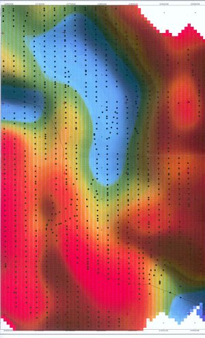
Gravity map over a salt dome onshore Louisiana. Blues are gravity lows,
red and greens are highs. Salt is demonstrated as the pronounced gravity low
in the middle of the map. The magnitude of the anomaly is proportional
to the depth and thickness of the salt. This maps was used fro a gravity inversion
to estimate the base of the saltm, to aid in PSDM salt imaging.
